es


"D4H is quick and easy to use, it gets me easily to the info I need."

“D4H has provided us with easier communication when managing large-scale incidents as well as simplified documentation. It also provides the ability to process and display the information that key players need to make decisions.”

“We absolutely love D4H. All ten councils in the Canterbury region are now using D4H along with a number of councils in the North Island.”
“As we come to the end of our first year with D4H I can proudly say that we have utilized the system to plan, document and manage two large scale events. We have utilized it to schedule, track and deploy all EMS resources during the Memorial Day Bike Week event in Horry County as well as the Fire-Rescue-EMS response to Hurricane Dorian.”

"About 80% of the crew had never used D4H before. At about three o’clock in the morning on the day of the deployment, I gave them a quick briefing to show them the software. After only a couple of hours, they had the hang of it."

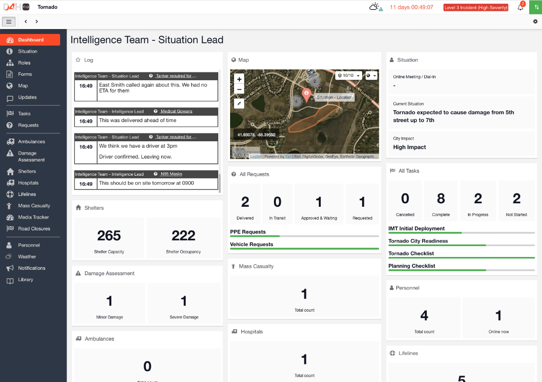
“Using D4H’s map layers, we plot evacuation thresholds based on the fire’s potential rate of spread. If a fire gets to one of the areas we’ve marked on the map, that’s a trigger point to evacuate. During more severe fire days, the areas on the map would be larger.”

"One thing I have found very worthwhile is that you can have all the initial tasks pre-loaded, so the team knows what to work on when they start their shift during an emergency."

"The great part is that once we enter information in D4H, it syncs up for everyone in real-time and it’s always there to look back on."
de respuesta de cientos de organizaciones utilizan D4H a diario.
países en 6 continentes están utilizando D4H para emergencias.
CO2e se ha compensado. D4H compensa su huella de carbono completa y un poco más.
árboles plantado por nosotros en bosques reales para ayudar a la reforestación del clima natural.